Tag Archives: The 10

From Glendale to Downtown LA and Back

Consider this post to be, um, sorbet, a palate cleanser before the long-promised meatier course – a course for which your impatience with the chef is no doubt growing.

Living in Palms, commuting to downtown was easy: I could take my early af carpool, or I could walk to Culver City station and take the Expo Line. Driving to downtown that early, there’s practically no traffic on the 10. But did I mention it was really early? The Expo Line, with 10-12 minute headways all day long, about a mile from my apartment, was the natural transit choice, unaffected by the whims of the traffic deities. If something disrupted rail service, like drivers behaving badly, the Venice bus routes (33/733) were a solid backup, even if the lack of bus lanes on that wide ROW west of Crenshaw got frustrating.

In Glendale, the length of my commute is the same, within less than a mile. I still have the option of the crazy early carpool, the one that lets me start tweeting when the rest of the West Coast is still dreaming. There’s still no delay driving at that time of day, but the background traffic on the 5 is significantly larger; on the 10, there’s nothing but ocean to the west, while on the 5, there’s a lot of long distance north-south traffic.

On the other hand, there’s no rapid transit to Glendale, so the transit options aren’t as good. The closest Metro bus route to me is the 94/794 on San Fernando Rd. As has been discussed on Twitter, the split between a local and rapid here is not particularly helpful, because the headways on both are large enough that you’re better off just taking whatever comes first. The 94/794 is nearly 30 miles long, about twice as long as many Westside bus routes, which makes it even harder to regulate headways. Lastly, the 94/794 uses Hill St downtown, which adds a lot of delay when traffic is stacked up getting on the 110.

You can try to skip past downtown congestion by taking the Gold Line to Lincoln Heights/Cypress Park, and taking a short walk to the 94/794 stop at Ave 26 and Figueroa. However, if Union Station isn’t one end of your trip, that means two transfers, and two transfers can add a ton of delay. Odds are, of course, that Union Station is not one of the ends of your trip.

Today, I finally tried taking Metrolink from LA Union Station to Glendale. The train left on time and it was a fast 10-minute ride to Glendale Station, which is near the southern end of the city by Los Feliz Blvd and San Fernando Rd. Even with zero traffic, you’d be hard-pressed to compete with that time by car. Thanks to Art Leahy and Mike Antonovich, the fare currently sits at a very reasonable $2; before the Antelope Valley Line pilot program, it was $5.50. Honestly, that kind of speed is probably worth $5.50 and I’m just a cheapskate.

Again, though, if you have to transfer, that advantage starts to rapidly dissipate. I happened to be at Union Station today; for most people a Red/Purple Line ride would be tacked onto the end, but service there is frequent enough that it’s not a big deal. At the Glendale end, I had to wait for the 94/794, and the last 2 miles of my trip ended up taking more than twice the time that the first 8 miles took. Glendale runs a bus, route 12, from the Metrolink station up San Fernando Rd; Glendale routes 1, 2, and 11 would also arguably be viable for my trip. The overarching problems with any of these transfer options are the potential for a long transfer delay and infrequent or non-existent service during off-hours.

Two final options that would serve my commute would be Metro bus route 92, and Metro bus 180/181/780 to a transfer to the Red Line. I haven’t had occasion to try these; to be honest, the traffic on Los Feliz Blvd scares me a little bit regarding the latter.

Meanwhile, the Metrolink tracks paralleling San Fernando Rd offer an intriguing possibility. But more on that another time.

Freeway Ramps and Crosswalks

We haven’t had a freeway post in a long time, but a while back we talked about short-term improvements that can improve the interface between freeways and city streets for pedestrians and bicyclists. The principle goal is to reset drivers’ minds for the urban environment by forcing them to slow down or stop when exiting the freeway, so that they don’t hit city streets at freeway speeds. The best designs for this are the tight diamond and the tight four-ramp partial cloverleaf.

Ideally, we’d like to also strengthen pedestrian connections by providing crosswalks on the city street that would run concurrent with the freeway off-ramp. The city street is often a major arterial road where the crosswalk spacing is too large, and a crosswalk at the ramp would help alleviate that problem.

xwalk-ramp

Here are two locations where such crosswalks were actually installed.

First, the 134 and Glendale Ave:

Second, the 134 and Pacific St:

Nice work, Glendale, on getting those tight diamonds, tight four-ramp partial cloverleaves, and extra crosswalks!

However, freeway ramps are not great locations for crosswalks. At most intersections, the majority of traffic goes straight, with smaller turning volumes, making it feasible to have concurrent pedestrian movements without much danger to pedestrians or impact to traffic capacity. At freeway ramps, though, the situation is reversed. Almost all traffic is turning, so concurrent pedestrian movements create danger to pedestrians and significantly reduce traffic capacity. While pedestrian safety can be improved at such intersections with a leading pedestrian interval, the other problems remain.

Fortunately, there’s a way around this issue that improves pedestrian connections, has a low impact on traffic capacity, and serves the goal of forcing drivers to adjust to city driving conditions. We can simply move the ramp crosswalks away from the freeway, and synchronize the traffic lights so that the crosswalk movement is concurrent with the ramps.

xwalk-midblock

This creates space for the traffic exiting the freeway to queue up. Since drivers exiting the freeway will always encounter a red light at the crosswalk, they will be forced to stop and reset their minds. Pedestrians do not have to contend with conflicting traffic, and the location of the crosswalk might better serve them. A crosswalk adjacent to a freeway will be located such that the freeway is occupying much of the nearby street frontage, whereas a crosswalk further away will serve more development.

If there’s an unsignalled minor street nearby, that’s a natural location for a new traffic signal and the crosswalk. Let’s look at a few examples around the county.

The 134 & Pacific in Glendale:

the134-Pacific

The 10 & Normandie in LA:

the10-Normandie

The 405 & Artesia in Torrance:

the405-Artesia

The 405 & Western in Torrance/LA:

the405-Normandie

These improvements obviously require new traffic signals, which is a considerable expense. Therefore, they should be rolled into either freeway improvement projects or arterial corridor improvements. The pedestrian signal is only a simple two-phase signal, and doesn’t need much intelligence since it will be synchronized with the ramp, which will help some with costs, especially if part of a larger job.

Westside Traffic, Peak Period Edition

A commenter on this post on Westside traffic asked if peak hour data might show different patterns, so I created similar graphics for the same roadways using the same data (Caltrans publishes peak hour, peak month, and yearly average traffic).

I’ll let the graphics speak for themselves. The peak hour patterns are quite similar to the total volume patterns, including the structural changes on the 405 and Venice coinciding with completion of the freeway widening project between the 90 and the 10. It’s actually a little surprising to see so much of a change in peak hour volumes – I would have guessed that changes in total volumes would be reflected in a shorter peak, leaving the peak hour itself relatively unchanged, rather than a more uniform change. These facilities are all near capacity, so if more cars enter the systems, peak volumes can only go up so much, and the increase would be expressed as a longer peak period and greater total delay.

I’ve put the daily volumes & peak volumes side by side so you can easily compare. Note that the y-scales are necessarily quite different. As always, click to embiggen.

Venice-both the405-both the10-both SM-both Lincoln-both

Is Westside Traffic Really Getting Worse?

Recently, the LA Times has published some articles positing that as freeway traffic gets worse, people have started using smart phone apps like Waze to try to avoid it, causing worsening congestion on neighborhood streets. The problem is that you can’t trust people’s perceptions of traffic. Traffic, like behavior of teenagers, is almost always perceived to be getting worse, data be damned.

Since Caltrans publishes freeway traffic counts going back to 2002, we can take a look at the evolution of Westside freeway traffic leading up to the last economic peak, the crash, and the current period of growth. Here’s a plot of traffic on the 10 between Lincoln and Vermont, from 2002 to 2013.

How to read: traffic volume is the vertical component. Time represented on the diagonal from top left to bottom right. The location on the freeway is represented west to east on the diagonal from bottom left to top right. So, if you follow a diagonal line from bottom left to top right, you’re seeing traffic volume on the freeway build as you head towards downtown. If you follow a diagonal line from top left to bottom right, you’re seeing how traffic has changed over time at a particular point on the freeway.

For example, following the diagonal for 2013, we can see that traffic is below 250,000 vehicles per day from Overland west, and above 250,000 vehicles per day from National east (where the line leaves the green area and enters the yellow band). Following the diagonal for Vermont, we can see that traffic volumes were above 325,000 at Vermont from 2002 to 2006, then between 300,000 and 325,000 from 2007 to 2011, and then back above 325,000 from 2012 to 2013.

If these graphics don’t make sense, there are some simpler line graphs at the bottom of the post showing the same freeways for years 2002, 2007, and 2013.

the10-contour

What can we see? Traffic declined across the whole freeway from Santa Monica to downtown LA as a result of the recession. West of La Brea, traffic volumes have not recovered or have declined even further, though east of there, traffic has started to recover. No boom in traffic on the Westside on the 10.

Here’s the 405 between the 90 and Mulholland (Sepulveda Pass). Information is the same, but the rotation is a little different to better show different patterns. I left the interchange with the 10 off the plot because it made a large, confusing dip between Olympic and Santa Monica.

the405-contour

From Wilshire to Sepulveda Pass, traffic volumes on the 405 haven’t increased noticeably either. There has, however, been a large increase in traffic between the 90 and Santa Monica since 2007. This correlates to both the economic recovery and the project that widened the freeway between the 90 and the 10 (induced/latent demand is real!).

Since some Westside arterials are still Caltrans-numbered routes (Lincoln, Santa Monica, and Venice) we can also look at trends on those facilities. Here’s Lincoln from the 90 to the 10.

Lincoln-contour

From the 90 to Washington, traffic volumes fell in the recession and have not yet recovered to previous peaks. The stunning thing here is the drop of 10,000+ vehicles per day between Venice and the 10 freeway. It seems possible that the completion of the widening project on the 405 shifted some traffic from Lincoln to the freeway.

Further evidence for that conjecture comes from Venice between Lincoln and La Cienega.

Venice-contour

Roughly coinciding with completion of the freeway project, Venice saw a considerable increase in traffic in the vicinity of the freeway and points east.

Lastly, here’s Santa Monica.

SM-contour

Nothing really jumps out here. Traffic declined during the recession, and consistent with national experience, has not recovered to previous peaks.

There’s no clear pattern of increasing traffic on these roads, but that doesn’t necessarily mean the story about worsening traffic on side streets is wrong. Technology like Google Maps and Waze makes information about the road network more accessible, and it’s certainly possible freeway and arterial traffic growth has been muted by people using the side streets. The city’s traffic data is also available through the Navigate LA website; maybe some enterprising person with programming skills can figure out a way to pull it out! Either way, it’s apparent there have been some shifts in traffic patterns, which we’d expect to make congestion worse in some places.

Note: 2009 data was missing, so I made it the average of 2008 and 2010.

the10-line the405-line Lincoln-line Venice-line SM-line

Eliminating Loop Ramps: The 10 at La Cienega and La Brea

In this introductory post on urban freeway improvements, the elimination of loop ramps and slip ramps was identified as some of the lowest-hanging fruit. It’s relatively cheap to do, and it makes things much better for bikes and pedestrians by getting rid of long, skewed crosswalks and road geometry that encourages drivers to speed. Since loops take up a lot of real estate, it also frees up a decent amount of land for development. Inspired by a recent comment, here’s a look at two interchanges on the 10: La Cienega and La Brea.

La Cienega

The westbound ramps at La Cienega are already in a tight diamond configuration, so there’s nothing to change there. The eastbound ramps are in a cloverleaf configuration, albeit a modified one, since Venice cuts through the vicinity. Thus, the northbound La Cienega on ramp to the 10 eastbound is a right on Venice, then a right on the ramp. The loops are very tight, with curve radii down in the neighborhood of 80’.

The basic idea here would be to remake the eastbound ramps in the image of the westbound ones. The interchange would become a modified tight diamond, with a new road connecting the two ramps between La Cienega and Venice. This would reconfigure the free movements to and from the ramps into normal city intersections, making them less hazardous for pedestrians and bikes. It would also yield new signalized pedestrian crossings of La Cienega and Venice, making things a little more walkable.

the10-LaCienega

click to embiggen

This concept uses 10’ lanes and 6’ curbside bike lanes on La Cienega. Now, I know what you’re thinking – why is there no crosswalk on the north side of the intersection of the new ramps and La Cienega? Three-legged pedestrian crossings are horrible! The reasoning is that adding a crosswalk there makes things considerably harder for the traffic engineering, and this location is a rare exception to the rule that you should never omit a crosswalk. Because there’s nothing on either side of La Cienega on that side of the ramps, there’s no chance a pedestrian would have to use all three crosswalks in lieu of the missing crosswalk. Anybody walking here is going to either a destination north of the 10, in which case they can cross at David Ave and the onramp to the 10 westbound, or a destination south of the new ramps, in which case they can cross on the south side of the intersection.

This concept adds two lanes under the freeway bridge. It looks like this might just fit under the existing bridge, because the east side has a row of parking between the existing edge of pavement and the columns.

On the traffic side, the loop ramps are both serving over 10,000 vehicles per day. Those turning movements, which are currently free (unsignalized) right turns, will be replaced with left turn phases at the new traffic signal. Excluding the crosswalk on the north side of the intersection makes that left turn easier, reducing the green time needed for the eastbound movement. Again, this is only acceptable because it’s a special situation. Here are the traffic volumes at the new intersection.

LaCienega-table1 LaCienega-table2 LaCienega-sketch

Traffic volumes are from Caltrans and LADOT. This is a really rough estimate. The approach was to guess at the worst conflict group (combination of movements that can’t proceed at the same time) for each intersection, and figure out the sum of capacities needed for each movement in the group. That’s the “g/C” column (green time divided by cycle time), representing the percentage of the total intersection capacity needed for that movement. For example, the left turn from the 10 eastbound to La Cienega northbound needs 23% of the capacity at the intersection. If the total of that column is greater than 100%, or even relatively close, the intersection is close to failing.

La Brea

The existing interchange at La Brea is a full cloverleaf, with loops almost as tight as 100’ radius. However, the interchange doesn’t function like a true cloverleaf, because the outer ramps have very sharp cure radii to and from La Brea, and the offramps using the outer ramps have traffic lights instead of free-flowing turns.

The plan at La Brea would be to reconfigure the interchange as a tight diamond, using the same parameters – 10’ lanes, 6’ bike lanes. There are two options, one with the ramps tight up against the freeway, and one with the ramps intersecting La Brea near where the outer ramps do today.

the10-LaBrea-1

click to embiggen

the10-LaBrea-2

it’s a perfectly cromulent word

The advantage of the first option is that it lets you do the same crosswalk trick as at La Brea. However, unlike at La Cienega, there’s no extra room under the freeway at La Brea. We can steal the weaving lane to get four lanes under the bridge, but that leaves only a single lane for the left turns onto the 10. Unfortunately, that probably won’t work on the traffic side.

By pushing the ramps further away from the bridge, the second option lets you fit in a second left turn lane, though due to the lane’s short length, it might be a little optimistic to assume it could be used to its full capacity. Also, because the second option puts the new development between the ramp intersections, it’s no longer acceptable to omit a crosswalk. That makes the traffic design more challenging.

Traffic volumes on La Brea are daunting – the road serves nearly 70,000 vehicles per day here, more than many freeways that are two lanes per direction. The heaviest ramp volumes are to and from the east, all approaching 10,000 vehicles per day.

LaBrea-table1 LaBrea-table2 LaBrea-sketch

This design would require the crosswalks closest to the freeway to be concurrent with the left turns from the freeway offramps, which might be difficult given the traffic volumes.

Palmer Paradise

Now normally this is the part of the post where I’d suggest auctioning off the real estate to the highest bidder, as long as they agree to do something with it other than surface parking. That way you don’t end up with prime real estate owned by the government sitting vacant for years because it was impossible to come to a consensus on what to do with the land.

But you know what? F!@# it. These freeway-adjacent sites are right in GH Palmer’s wheelhouse. Just dial him up and let’s get us a few hundred Italianate apartments built. We can call them The Palude and The Catrame (the Italian equivalent of La Cienega and La Brea).

Traffic Troubles

While the idea of improving these interchanges for pedestrians and bikes, and freeing up space for urban development, is appealing, the worst g/C ratios approach 1 at both interchanges. More traffic study would certainly be required to see if these plans are viable.

Politically, any plan to eliminate loop ramps is going to have to win the support, or at least the grudging tolerance, of drivers. Unfortunately, these interchanges are not the best candidates for the first project, because if the first project doesn’t go well, there won’t be any more. Back to the lab again. . .

 The sausage-making behind this rough traffic analysis: I assumed the ramp volumes have the same peaking as the through movements on the 10, and 1,700 veh/hr capacity for each lane at the intersections. The critical conflict group at La Cienega was assumed to be Offramp EB – La Cienega NB – La Cienega SB left turn. At Venice, Onramp EB (from the La Cienega SB left turn) – Venice EB – Venice WB left turn. No volume was available for the last movement so it was a wild guess. The critical conflict groups at La Brea were assumed to be Offramp EB – La Brea NB – La Brea SB left turn, and Offramp WB – La Brea SB – La Brea NB left turn.

Brighten Up the Bottomside of the 10

Wut, another freeway post?

We’ve talked before about the need to think about short-term improvements to freeways that strengthen the city fabric and make streets safer and more comfortable for bikes and pedestrians. That post was really geared towards everything on the surface of freeways and interchanges, but what about the area underneath freeway viaducts? There are things that could be done in the short term to improve these environments too.

Keep Houston Houston already did the legwork on this one; here’s the quick takeaway on how the undersides of viaducts and bridges should be designed:

  • Face with a solid surface. Beams and trusses create cavities that get filled with trash, guano deposits, and in some cases, affordable housing. California has an advantage here because most of our freeway bridges are continuous reinforced slabs or box girders, which already have a smooth, solid, continuous underside.
  • Paint a bright color, for obvious reasons.
  • Illuminate with bright lighting, also for obvious reasons. The lights used should be cool white LEDs, which produce a more appealing light spectrum. Traditionally, this type of outdoor lighting has been done with sodium vapor lamps, which are cheap and bright, but produce that characteristic industrial yellow glow. However, LED capital and operating costs have fallen to the point where they’re practical.
  • Bump up the level of density and activity abutting the freeway. If you want it in Jacobsian terms, a freeway viaduct is a long, skinny border vacuum. Making each side more active helps bridge the gap.

Quick Fix Bridges

For a simple case, here’s how things look today in Palms, on National underneath the 10:

What does this need? New lighting fixtures, a coat of white paint on top, and maybe some murals from local artists on the walls. This can be done quickly and for low cost. Here, enjoy an awesome MS Paint rendering of the same:

the10palms

In some places, there’s already been some progress. For example, in Santa Monica, Pico was spruced up where it goes under the 10. It’s not all the way there, but it’s a start:

A Little More Work for Viaducts

I think the most interesting candidate for improvement right now is the 10 between the 110 and Olive Street. This area has already seen significant infrastructure investment in the Expo Line, and more is hopefully on the way with My Figueroa. On the north, the area bounded by the 10, the 110, 7th, and Hill is one of the hottest development markets around. To the south, USC has plans to develop new buildings, in addition to the massive Lorenzo project.

This makes the 10 viaduct a good candidate for enhancement, since it would contribute to growth in the area by making the street fabric more inviting for walking and biking. The 10 viaduct continues all the way to the river, of course, but east of Hill things are more industrial, so focusing on the stretch from the 110 to Olive will give the most bang for the buck.

the10area

Viaducts are a little harder to deal with than simple underpasses, because they create a long continuous break in the city. Often, the space underneath is used for low end uses like car or bus parking, partly because it’s not exactly a pleasant area and partly because those uses can easily be moved if you need to do maintenance.

However, it’s possible to locate more active land uses under freeway viaducts. It’s probably not a good location for apartments, but commercial, retail, and light industrial uses can work. For example, here’s some simple commercial/retail uses under the 10 between Olive and Hill:

And here’s a building (with unfortunately solid walls) under the 10 at National and Robertson:

If we look beyond LA, here’s a supermarket under the rusting hulk of the West Side Highway in Manhattan. It was always pretty busy whenever I visited:

Or try on this example near Smith-9th in Brooklyn, with a 4-track railroad viaduct going over buildings.

The key is having enough of an active city around the viaduct that it can support those retail or restaurant uses. As the corridor between LA Live and USC continues to grow, that’ll happen. I’m sure some enterprising businessperson can figure out how to turn the challenges into opportunities. For example, I’m told that exposed concrete columns are more authentic than drywall, and can be an attractive design feature in a building. Another opportunity would be to use the transverse gaps in the viaduct, say near Flower and Figueroa, to create interesting architectural features that would channel sunlight to the insides of the buildings underneath.

Maintenance Matters

Like anything, a big question is how much this will cost and who will pay for it. Caltrans probably isn’t interested in doing anything other than meeting their core mission of keeping these things in a state of good repair. The city probably isn’t interested in picking up the tab for upkeep like painting and washing either. With all the development in the area, maybe there’s an opportunity for a business improvement district to be organized to be in charge of such a project, which would increase property values in the area.

Again, it’s important to look for easy opportunities like this to make short-term improvements to the city. There’s probably more disagreement about the long-term disposition of urban freeways, but that shouldn’t stop us from doing what we can quickly to make the city a better place.

What Are the Arguments Against New Freeway Capacity?

The current conventional wisdom in urban planning is that freeways are bad. As a result, the usual response to any plan to build a new freeway or widen an existing one is to throw the book at it, and hope something sticks. This is straight out of the NIMBY playbook, and if you have enough money and good lawyers, you can usually find some technicality that will at least delay the project and force the proponents to pretend that they like to waste their money on “mitigation”. These arguments don’t have to be logically consistent, they just have to work. For example, you can argue that the new freeway lanes will be filled with cars before you know it, and that the new freeway lanes will go unused. Take your pick.

Engineers, though, we’re pretty agnostic. You go to school to learn how to design railroads, and in calculus, you sit next to someone going to school to learn how to help the CIA blow up railroads with unmanned drones. Whatevs. And that’s how it should be. You don’t want the police selectively deciding what laws they’re gonna enforce and who’s gonna be on the receiving end of that enforcement based on their personal opinions. And you don’t want your engineers to do a crappy job on your track design because they have a philosophical disagreement with streetcars. By the time things reach the engineers, all the relevant planning decisions have already been made. Even if I think your project is a bad idea, I’m gonna give you the best damn design possible.

When I look at things at a planning level, I try to bring that same sense of doing things efficiently. When I get upset about a freeway project, it’s not because it’s a freeway per se, but because (a) it’s in a place where there’s no need for any new transpo or (b) there would be a better way of meeting the travel demand. There are lots of bad freeway projects in the US, that are a waste of money and resources because they’re not very efficient. The planning level is the right level at which to stop these projects. So with that in mind, here’s an engineer’s assessment of the quality of planning level arguments against new freeway capacity.

No Demand

An easy one to forget, but like the do-nothing alternative, sometimes it’s the best. If there’s no demand for the facility, there’s obviously no point in building it. Since there is usually pent-up travel demand in cities, this argument is best applied to the pointlessly proliferating pork barrel rural freeways like the I-99 and the I-69.

Induced Demand

If anything, this is an argument in favor of new freeway capacity. Induced demand, as Kurumi whimsically put it, is the tragedy of a highway, once built, being used as intended. When urban planners talk about induced demand, they always do so as if it were some evil willed into existence by the freeway – like the additional people and goods moving around are just out there for the hell of it. But that additional traffic represents people who were able to move to the city for a better job, businesses that were able to reach more customers, friends who were able to head across town to meet for dinner.

Put another way, let’s say that we decrease the peak period headways on the Blue Line from 6 minutes to 4 minutes, and in a couple years, all the new trains are just as full as the existing trains today. Would anyone make the argument that the project was a failure because the trains are just as crowded? Of course not.

Increased traffic volumes do result in an increase in negative externalities like air pollution. The proper course of action is to appropriately price the negative externalities of driving. Indeed, if externalities were appropriately priced, the apparent need for many freeway projects would vanish. Controlling them by restricting capacity is like controlling people’s sewage output by not installing a larger pipe. It might work, but it’s not pretty.

Declining VMT

Now we’re getting somewhere. In the past, traffic predictions were usually too low. Today, they seem to be too high. If you’re reading this, odds are there’s no need for me to go into too much detail, but per capita vehicle-miles traveled (VMT) has been declining since 2004. This is due to a combination of the Baby Boomers aging (old people drive less), young people wanting to drive less, a significant increase in the price and price volatility of gasoline, stricter licensing laws, and the general economic malaise of the last decade. The relative importance of each of those factors is determined, of course, by the writer’s preexisting bias.

Declining per capita VMT can be a pretty solid argument against increasing freeway capacity, but it depends on the rate of population growth in your region. Let’s say that per capita VMT is declining at 1% per year. If you’re Houston, and your population is growing at 2.2% per year, the total VMT in your region is still going to up. Empty capacity in Cleveland doesn’t do you any good. Now, you could argue that something else would be a better transportation alternative than a freeway to meet that demand, but that’s a different argument, discussed in more detail later.

On the other hand, what if you’re Cleveland or Buffalo or Detroit, or any city that has lost population in the core while growth in the region has been anemic, if that? Well, you might want to reconsider expanding your roads. It’s hard to imagine that any of those three cities needs a major roadway expansion project. You have to wonder what MDOT is thinking when they write an EIR for widening the I-94 that says the city might lose residents due to the negative externalities of the wider freeway, but that they can be replaced with more commerce. Really, Detroit is lacking vacant land for commerce?

So declining per capita VMT might be a good argument; it depends on the city.

Parking Capacity

This starts to get into network effects, which are naturally more difficult to understand and model, and therefore more readily ignored. You could say that you don’t want to make it easier for people to drive to a destination because it will make the parking situation worse. Parking capacity is nominally easy to fix by building structured parking, and at some point, people will just stop driving to the place if they expect parking to be exceedingly difficult to find. This isn’t really an argument against building new freeway capacity so much as an argument for better parking policies, which is a separate issue. I think some guy named Donald Shoup wrote a book about that.

Local Street Capacity

Insufficient local street capacity is a great argument against building new freeway capacity. Local street capacity is limited by the available ROW, the need to provide space for competing uses like sidewalks, bike lanes, and street parking, and the need to split green time between conflicting movements at traffic signals.

Jarrett Walker likes to say that one of the best arguments for transit is geometry, because no technology can repeal its laws. Likewise, an important feature of the local street capacity constraint is that geometry makes it very difficult to resolve. Ultimately, and fairly quickly, you run into the need to do things like grade separate intersections and widen ROWs – things that are very expensive and unpopular, to say nothing of ruining the attributes that made the destination attractive in the first place.

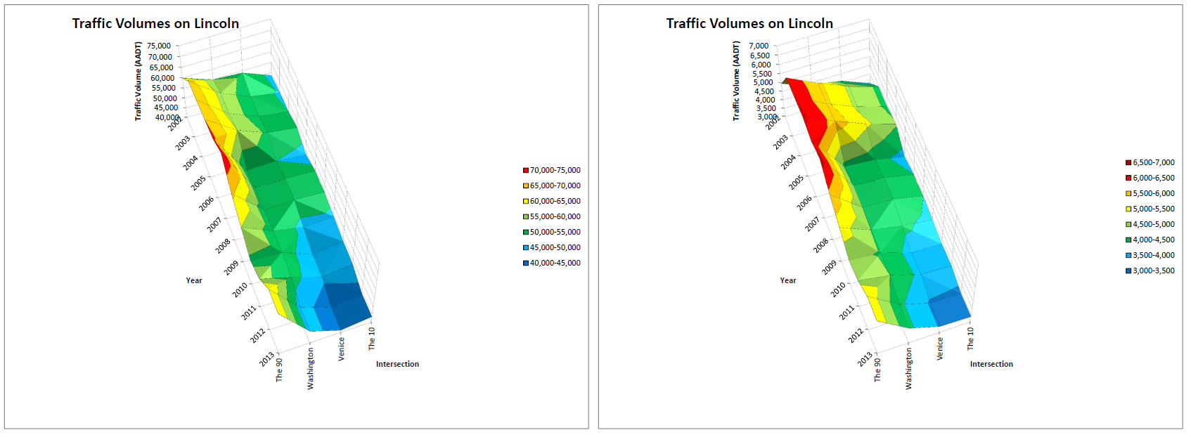
A classic example of this is the 10 freeway in Santa Monica. There is a lot of congestion going westbound in the morning, starting at the off-ramp to Cloverfield and 26th and building back from there. The two-lane off-ramp queues back onto the highway, and before long, it’s curtains for all the westbound lanes and the ramps from the 405 too. The issue here is that the local streets in that area are saturated. It would be pointless, perhaps even counterproductive, to widen the 10, because it might make the situation on the local streets worse, and there’s no room to expand those streets.

Local street capacity in Long Beach is popping up as a reason to not widen the 405 in Orange County, and it’s a great argument. (Contrast this with the congestion on the 10 east at the junction with the 110, where the primary issue seems to be insufficient weaving distance on the 110 at the downtown exit and the 101.)

Better Transportation Alternative

As an engineer, this is pretty much living the dream. Nothing makes an engineer more content than coming up with a more efficient way to do things. And happily, there are a lot of ways to come up with a better transportation alternative. It could be a transit option. It could be fixing bad parking policies. It could be something that costs less. It could be just making more efficient use of existing infrastructure through things like improving signal timings and ramp metering.

This is the reason that all good engineers should love bike infrastructure. Even if you don’t think biking is fun, even if you ignore the health benefits, even if you think the political left is using it as a pretext to turn ‘Murica into China or Europe, in your cold engineer’s heart, you have to accept that biking is a very efficient way to serve mid-distance trips that are too far for walking, but not long enough to capitalize on the advantages of cars or transit. The advantages of cars and transit increase as the length of the trip increases, but the disadvantages are relatively fixed access problems, e.g. getting to/from the transit station or parking and getting to/from the arterials and freeways.

Los Angeles, coincidentally, is a city with huge bike potential. The pattern of development and density in LA naturally lends itself to trips of that length, and the street grid makes it easy to provide the infrastructure.

Case Study: Expo Line

Let’s take a look at an LA case study: the Expo Line, as compared with the option to widen a competing freeway, the 10, between Downtown LA and Santa Monica.

Note that right away, we can see that induced demand is no good. You’re fooling yourself if you think auto travel on the 10 and transit trips on the Expo Line are zero-sum. We’re certainly hoping that the Expo Line is going to induce some demand! Declining VMT is probably not a good argument here either. The LA area keeps growing, traffic on the 10 is already terrible, and the Westside in particular would be gaining population quickly if we’d get rid of the foolish zoning that prevents it from happening.

Parking capacity is a pretty good argument in Santa Monica and Downtown LA. As much as people in Palms and Culver City might complain, the parking situation there is actually pretty liquid. As surface parking lots and low-rise buildings in Santa Monica and Downtown LA are converted to mid-rise buildings, hotels, and high-rises by market demand, the cost of building parking spaces goes way up, because a structure parking spot costs about ten times what a surface spot does. If parking is unbundled and parking minimums are eliminated, many trips to or from these locations will naturally gravitate to transit, which is a more efficient way of serving those trips. This also makes a greater variety of land uses viable, and that’s a good thing. Finally, Carter Rubin would tell us that building more structured parking in Santa Monica will have a negative effect on the economic productivity of the area.

Local street capacity is a really good argument in both Santa Monica and Downtown LA, because in both places, the local street network is saturated during peak periods. In downtown, some of this is spillover congestion from the gridlock on the 110 and the 101. In Santa Monica, the aforementioned congestion on Cloverfield, as well as the greater 3rd St area (Ocean to Lincoln, Pico to Wilshire), seems to me to be almost entirely a function of local streets being maxed out. Expo Line allows for growth to continue in both neighborhoods without the need to undertake expensive highway projects. Palms and Culver City local streets aren’t terrible, though downtown Culver City can be bad at times.

Right in line with parking capacity and local street capacity constraints, we can see that the Expo Line is a better transportation alternative than widening the 10. A new lane on the 10 would have a capacity of about 2,300 veh/hr, or at an occupancy of 1.5 pax/veh, 3,450 pax/hr. The Expo Line, running 6 minute headways, has a capacity of about 10 train x 3 veh/train x 100 pax/veh = 3,000 pax/hr. The difference is, the congestion on the 10 is so bad, there’s no way it actually will carry that many people during peak periods. (Many people would argue that we could eliminate that issue with congestion pricing; while I’m in favor of HOT lanes, I think the idea of tolling all freeway lanes is impractical – an issue I’ll take up another time.)

Since Expo Line and the 10 don’t follow exactly the same corridor, there’s the benefit of providing better transportation to parts of the city that wouldn’t benefit as much from the 10 project. It lets trips on the Expo Line corridor avoid traveling north-south to the 10. That spreads the transportation wealth, since people near the 10 already have a high-quality transportation facility. (Some people don’t like living near a freeway, but hop on Westside Rentals and see how many listings say “convenient to the 405”.)

In terms of cost, Expo Line is probably a winner too. Widening the 405 by one lane between the 10 and the 101, about 10 miles, is costing over $1b. The project to add four lanes to the 5 between the 605 and Artesia, about 7 miles, is $1.6b but doesn’t involve the amount of retaining walls of the 405 project or a potential project on the 10, though it likely needs more ROW. Adding two lanes to the 10 between 4th St and Crenshaw, the logical limits and about 10 miles, would probably at least $2b. Add in the costs of additional parking and local street capacity in Santa Monica and downtown LA, and you’re in the neighborhood of the Expo Line’s $2.5b cost. The Expo Line will also make efficient use of available capacity elsewhere in the system (Gold Line and the forthcoming Regional Connector) that is not available to a project on the 10, since the 110 and the 101 are jacked.

Argue Smart

A victory on a technicality might feel great in the short run, but in the long run it’s Pyrrhic. The proponents of projects get wise and produce ever more voluminous studies. The same tactics can be used to stop good projects; pick your favorite transit project, and odds are it’s facing a bogus NIMBY lawsuit. Continued frustrations build a political movement to change the laws on environmental review (which, though I think it needs to be addressed, if done poorly could open the door for harmful projects). You can only win on technicalities for so long, as Expo Line opponents just found out.

Stick to the arguments above, though, and you’ll have a solid case every time. Laws can fix trivial details, but they can’t change the laws of logic, geometry, and efficiency.